

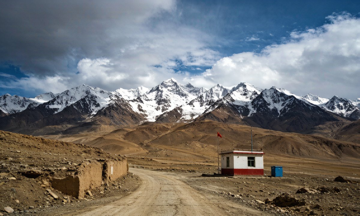
Forty kilometres past the last mast on the G314 toward the Pamir, my phone map went blank — and the only reason I kept driving the right way was the offline maps I had downloaded in Kashgar the night before.
Xinjiang is huge and empty in exactly the places you most want to drive: the G3012 along the Tarim, the G217 over the Tian Shan, the G314 up to the Khunjerab. Signal is patchy to nonexistent for long stretches, and a dead map at a junction with no signs in Latin script is a real problem. The fix is boring but essential: download offline maps before you leave each town, carry a second navigation method, and know which stretches are truly dark. This guide covers what works, what does not, and how to navigate the dead zones between Urumqi and the Pamir without guessing.
Download offline maps before you leave town
Every mapping app that works in China — Amap (Gaode), Baidu, and the international apps with China tiles — lets you download province or city offline packs. Do it on hotel Wi-Fi in Urumqi or Kashgar, because the packs are large and mobile data in the boondocks is slow or absent. I download the whole of Xinjiang plus the specific counties I will cross: Korla, Aksu, Kashgar, Tashkurgan. Offline maps still show roads, towns and your moving dot using the phone’s GPS, which works without a signal. The mistake travellers make is downloading only the start city and assuming the rest will stream — it will not, and the G314 past the last checkpoint is exactly where you need it most.
- Download the whole region + county packs
- Use hotel Wi-Fi; packs are large
- GPS dot works offline; only tiles need caching
What the dead zones actually are
The truly signal-free stretches are the mountain passes and the open desert. The Duku Highway (the G217 segment from Dushanzi to Kuqa) loses signal for long runs, especially in the tunnels and the high hash marble pass near 3,400 m. The G314 from Karaqi toward Tashkurgan and the Karakul Lake has gaps of 30–60 km with no bar. The Taklamakan Desert Highway (the G3012 crossing) is empty for hours. On all of these, a checkpoint officer may ask where you are going — have the offline map open to show the route, because ‘to the Pamir’ is not an answer they can log. Plan fuel and toilets around the last mast you passed, not the next town.
- Duku G217: long gaps, tunnels, high pass
- G314 to Tashkurgan: 30–60 km blanks
- Desert highway: hours of empty space
A second method: screenshots, GPS unit, paper
Never trust one system. I keep three: the phone app with offline tiles, a folder of screenshot maps of the day’s key junctions (saved to the gallery, openable with no app), and the rental’s built-in GPS if it has one. A standalone GPS or a watch with offline topo maps is overkill for the highways but gold on a side track to a lake. Paper road atlases exist in Chinese bookshops and are worth one for the big picture. The point of a checkpoint is that you can show a route even when nothing loads, so a screenshot of ‘here to Tashkurgan via G314’ settles it faster than arguing. Redundancy is the whole strategy in the dead zones.
- Phone offline tiles + screenshot folder + car GPS
- Screenshots need no app to open
- Paper atlas for the big picture
Fuel, tolls and the map that does not show them
Offline maps show roads but not always live fuel or toll status, and that is where the road book matters. The G30 and G7 are tolled; the desert and mountain roads are not, but they have fewer stations. I mark every fuel stop on the offline map the night before, because a station that the app shows may be closed for prayer or out of diesel. Car trouble in a dead zone means you need the map to tell the breakdown truck roughly where you are — give the kilometre post or the last village, not a pin that will not load. The map and the fuel plan are one task: plot both before you roll.
- Mark fuel stops on the map the night before
- Tolled: G30, G7; free: mountain/desert roads
- Give km-post, not a pin, if you break down
Border permits and the map that proves your route
On the Pamir leg you need a border permit from the Kashgar Public Security Bureau, and the officer at the checkpoint will want to know your destination — Tashkurgan, Karakul, the Khunjerab if open. Have the offline map showing your route so you can point, not explain. The permit names the places you may enter; do not wing it toward an unlisted village because ‘the map shows a road.’ The checkpoint is also where a wrong turn costs real time, so the map you downloaded in Kashgar is doing double duty: navigation and paperwork. I keep the permit and the open map together in the door pocket.
- Get the border permit in Kashgar first
- Show the route on the offline map at the checkpoint
- Permit lists villages — do not stray off it
Practical setup for a driving day
My routine: the night before, on Wi-Fi, download or refresh the region pack and screenshot the day’s three key junctions. In the car, mount the phone, start navigation with the offline pack, and switch the app to offline mode so it does not waste battery hunting a signal that is not there. Carry a car charger and a power bank; a dead phone in a dead zone is the one failure mode that ends a trip. Tell someone your plan and expected arrival so a missed check-in means something. None of this is high-tech — it is just doing the download before the signal dies, which most people only learn after it already has.
- Refresh packs + screenshot junctions the night before
- Switch app to offline mode to save battery
- Charger + power bank; tell someone your plan
| Road | Signal | Prep | Risk |
|---|---|---|---|
| G30 (Urumqi–Khorgas) | Patchy between cities | Region pack | Missed exit |
| G217 Duku | Long gaps | Offline + screenshots | Wrong pass turn |
| G314 to Pamir | 30–60 km blanks | Permit + map | Off-permit village |
| G3012 desert | Hours empty | Fuel marked | Out of diesel |
Practical takeaways
- Download the whole region and county packs on Wi-Fi.
- Carry a screenshot folder as a no-app backup.
- Switch the app to offline mode to save battery.
- Get the Pamir border permit in Kashgar before driving.
Frequently Asked Questions
- Do maps work without signal in Xinjiang?
- Yes — download offline region packs; the phone’s GPS still shows your position with no signal, so you can navigate the empty stretches.
- Which roads have the worst dead zones?
- The Duku Highway (G217), the G314 toward Tashkurgan, and the Taklamakan Desert Highway (G3012) all have long signal-free runs.
- Do I need a border permit for the Pamir?
- Yes — get it at the Kashgar Public Security Bureau and carry the offline map to show your route at the checkpoint.
- What if I break down with no signal?
- Give the kilometre post or last village to the recovery truck; mark fuel and help points on the map before you leave town.