

If the Duku Highway is Xinjiang’s headline mountain road, the Yizhao Highway is the one locals in Ili quietly prefer. It’s shorter, steeper, and in many stretches more vertiginous than its famous cousin — a 120-kilometer thread that climbs out of the green bowl of the Ili Valley, switchbacks over the Ulanmaobdao Pass at more than 3,000 meters, and drops you into the horse country and golden rapeseed fields of Zhaosu. Drivers who have done both call it “the mini-Duku,” but that undersells it. The Yizhao is its own kind of beautiful, and for anyone building an Ili to Zhaosu road trip it is the single most memorable stretch of tarmac in the valley.
This guide covers the route, the all-important seasonal window, the checkpoints you’ll meet, and the small driving truths that make the difference between a white-knuckle slog and a joyful afternoon.
What the Yizhao Highway actually is
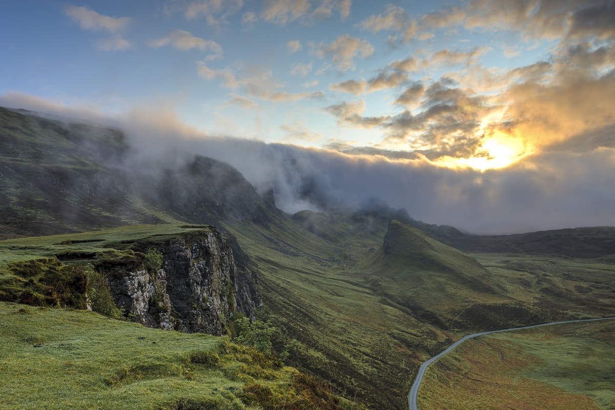
The road is officially the S237 state route, running from the southern edge of Yining (Gongliu County) to Zhaosu County. It does not cross the whole of Xinjiang the way the Duku does; it connects two corners of the Ili Kazakh Autonomous Prefecture. That short distance is exactly its charm. In barely 120 km you gain and lose over 2,000 meters of elevation, and the scenery changes from irrigated farmland to spruce forest to alpine meadow to treeless pass to sweeping steppe — sometimes within a single glance out the window.
Most of the road is two lanes, paved, and well maintained in the open season. The drama is concentrated in the central third, where the climb to the Ulanmaobdao Pass winds through a series of hairpins that locals count rather than measure. The pass itself is often capped with snow well into late spring, and even in high summer a cold wind pours down off the Tianshan.
When it opens — and why that matters
Like the Duku, the Yizhao is seasonal. Snow closes the high pass for roughly half the year.
- Typical open window: late May to early October, sometimes a little longer in warm years.
- Best months: July and August, when the Zhaosu rapeseed (canola) blooms into a yellow sea and the grasslands are at their greenest.
- Shoulder risk: June and September are gorgeous but weather-dependent; a cold snap can close the pass for a day or two with little warning.
- Winter: closed. Do not plan a winter crossing — the pass is not plowed and there is no alternative at that latitude.
Always confirm the current status with local traffic authorities before you commit, because the exact opening date shifts year to year with snowfall. The best time for a Xinjiang road trip overlaps almost exactly with this window, which is one reason Ili is busiest in July and August.
The drive, north to south
1. Yining → Gongliu (north foot). You leave the city through orchards and poplar-lined canals. Traffic is normal, the road is flat, and you’ll pass the usual checkpoints where you show your passport or ID. Fuel up here — it’s the last easy fill before the climb.
2. The ascent. The road begins to climb in earnest past Gongliu. Spruce gives way to open hillside, and the first switchbacks appear. This is where you understand why people compare it to the Duku: the road simply wraps itself around the mountain.
3. Ulanmaobdao Pass (Wulanmaobdao Da Ban). The high point. On a clear day you can see the layered ridges of the Tianshan stacked toward Kazakhstan. There’s usually space to pull off and photograph, but pull completely clear of the lane — tour buses use this road too.
4. The descent into Zhaosu. The world opens up. Pine forest thins, the air warms, and the steppe spreads out below: the famous Zhaosu grasslands, the rapeseed fields in July, and on the horizon the pale line of the Tekes River valley.
Driving tips that actually help
- Start early. Morning light on the north face is spectacular, and you’ll beat the midday tour-bus convoys that can back up at the pass pull-offs.
- Watch the blind crests. The road has many rises where you cannot see oncoming traffic. Slow down, stay right, and don’t overtake near the top of a hill.
- Fuel and water. Fill in Yining or Gongliu. There are small settlements but reliable fuel is thin on the climb. Carry water — the pass is high and dry.
- Weather changes fast. A sunny valley morning can become a sleet squall at the pass within an hour. Pack a layer even in July.
- No drones near the pass. Some sections sit close to sensitive areas; respect signage and checkpoint instructions.
- Foreign drivers: you’ll pass the same ID checkpoints as everywhere in Xinjiang. Carry your passport and, if you’re self-driving, your temporary driving permit. The Yizhao itself does not require a border-defense permit, but the broader Ili region’s checkpoints are routine.
What’s at the Zhaosu end
Zhaosu is worth more than a pass-through. It is the home of the “Heavenly Horses” (Tian Ma) of Chinese legend, and the annual horse festival draws riders from across the prefecture. In July the rapeseed bloom turns the valley chartreuse-yellow as far as you can see — a sight that has its own dedicated pull-offs and photo platforms. From Zhaosu you can loop north toward Tekes (the famous bagua — eight-trigram — city layout) or continue east to connect with the Yili grassland loop through Nalati and the wider valley.
 Nalati grassland rolling green hills” />
Yizhao vs the Duku — which should you drive?
They are not competitors; they’re complements. The Duku is longer, higher, and crosses the entire Tianshan from north to south. The Yizhao is a half-day jewel confined to Ili. If your Xinjiang road trip itinerary keeps you in the north, the Yizhao delivers 80% of the Duku’s drama in a fraction of the distance. Many travelers do both: the Duku as the grand crossing, the Yizhao as the local favorite.
One practical note: the Yizhao closes earlier in autumn than the Duku and opens later in spring, because its single high pass is more exposed. Plan Ili around its window, not the other way around.
FAQ
Is the Yizhao Highway paved? Yes — fully paved two-lane tarmac in the open season, suitable for any normal car.
Can I drive it in a regular sedan? Absolutely. No 4WD needed. The challenge is the switchbacks and weather, not the surface.
How long does it take? Plan 3–4 hours with stops, more if you linger at the pass or photograph the descent.
Is there cell signal? Decent near Yining and Zhaosu; patchy on the pass. Download offline maps before you leave the city.
Do I need a special permit? No border-defense permit for the highway itself, but carry ID/passport for the routine checkpoints.
Final word
The Yizhao Highway is the road I send people to when they say they loved the Duku but wish it were shorter. It is Ili in miniature — farms, forest, pass, and steppe in a single unforgettable climb. Time it for summer, start early, and give yourself the whole afternoon to reach Zhaosu slowly.
Written by Karl Huang, a Xinjiang-based travel writer. Seasonal opening dates and checkpoint rules change year to year — confirm with local traffic authorities before you travel.