

Seven days is the minimum I recommend for a northern Xinjiang loop, and it is a brilliant one. You get the Duku Highway, the green meadows of Nalati, the blue shock of Sayram Lake, and the golden birch of Kanas and Hemu — the Altai-and-Ili combo that is, for my money, the prettiest corner of the whole region. I ran this exact route in late September and the Kanas birch were on fire with color.
The trick with seven days is discipline: you cannot add Turpan or Kashgar without breaking the rhythm. This loop stays north of the Tianshan and rewards you for it. My longer northern Xinjiang road trip loop adds days if you have them.
The route
Urumqi → Dushanzi → Duku → Nalati → Yining/Sayram → Burqin → Kanas/Hemu → Urumqi.
About 2,000–2,200 km total. Two long transfer days; the rest are short and scenic.
Day-by-day
Day 1 — Urumqi to Dushanzi (~250 km, 3 hrs). G30 west. Overnight Dushanzi; see the Grand Canyon if there is light left.
Day 2 — Dushanzi to Nalati via Duku (~230 km, 5–6 hrs). The spine. Hashilagen Pass ~3,400 m. Overnight Nalati.
Day 3 — Nalati to Yining via the grasslands (~250 km, 4 hrs). Roll through the Ili valley. If it is June–July, the lavender fields around Yining are worth a stop. Overnight Yining.
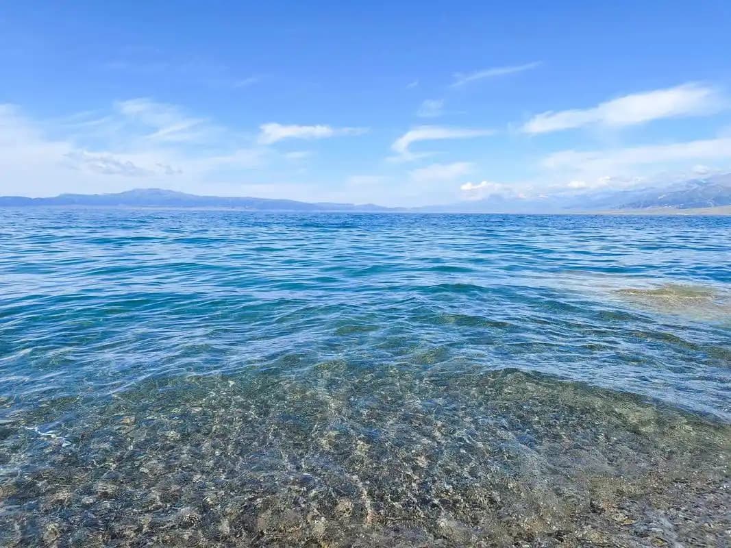
Day 4 — Yining to Sayram Lake (~90 km) to Burqin (~450 km, full day). Dawn at Sayram (use the Sayram Lake guide for the ring road), then a long run north to Burqin. Overnight Burqin.
Day 5 — Burqin to Kanas (~140 km, 2.5 hrs). Lakeside. Overnight Jiadengyu or inside the park.
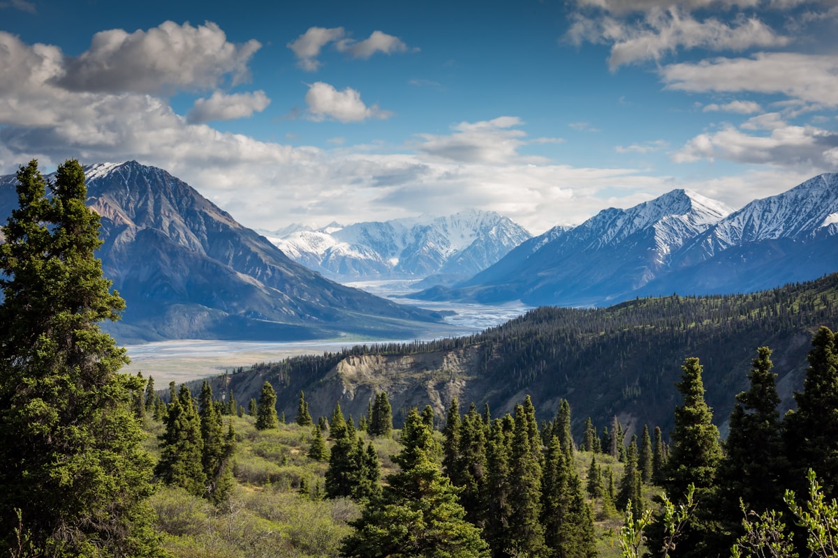
Day 6 — Kanas to Hemu (~70 km). Birch, timber roofs, morning mist. Overnight Hemu.
Day 7 — Hemu to Urumqi (~650–700 km). Long haul home via Fuhai and the G216/G30. Fly out.
Altitude and the temperature swing
The loop lives between 800 m (Urumqi) and 3,400 m (the Duku’s Hashilagen Pass), with most overnights high but comfortable: Dushanzi ~500 m, Nalati ~2,000 m, Sayram ~2,070 m, Burqin ~500 m, Kanas ~1,300 m, Hemu ~1,400 m. The real shock is temperature, not height. A July day at Sayram can be 22–25°C and the night 6–9°C; the Duku summit is often 10–15°C colder than the valley you left an hour earlier. Pack a real insulated jacket even in August, and keep a warm layer in the car at all times. The altitude is mild enough that most people feel only a light breathlessness at the Duku lookout.
The seasonal window for the north
Northern Xinjiang has two distinct good seasons. Summer (June–August) brings green meadows, wildflowers, and the Ili lavender (peak late June to mid-July), but also the crowds — Sayram lakeside and Bayinbuluke rooms sell out weeks ahead. September, especially mid-to-late, is my pick: the Duku is still open, Kanas and Hemu turn amber, and tour buses thin out. The shoulder risk is the Duku’s first snow, which can arrive in early October and close the pass. Avoid May: the Duku is usually still shut and the Altai is muddy and grey. Read the best time for a Xinjiang road trip and aim for September if you can.
Checkpoints and the Kanas border zone
You will pass routine police checks on the Urumqi G30 corridor and again on the Burqin–Kanas approach, which sits near the Altai border with Kazakhstan, Russia and Mongolia. No border permit is needed for standard Kanas entry, but the checks are more frequent here than elsewhere in the north — keep your passport or ID and rental papers ready at every window. Dashcams off if asked, and never photograph a checkpoint. The Kanas geopark itself also scans ID at the gate, so have it in hand when you buy tickets at Jiadengyu.
Fuel, water and resupply
Stations are frequent on the G30 and around Yining, but the Duku has no reliable fuel and the Burqin–Kanas road is the last easy top-up before the park. I fuel to full at Dushanzi (Day 1) and again at Yining or Burqin (Day 3–4) and hold the half-tank rule on mountain legs. Water is plentiful in towns; carry 2–3 L per person for the Sayram dawn and the Kanas hikes. Cash (¥200–300 small bills) covers the roadside stalls and the occasional card-less pump near the parks.
What to drop if a day is lost
If weather closes the Duku (rare but possible in early June or October), bypass it via the G30 to Yining and skip Nalati — Sayram and the Ili valley still deliver. If you must cut one night, drop Yining and sleep at Sayram instead. Never drop Kanas; it is the anchor of the north.
Season matters more here than anywhere
Northern Xinjiang has two peak faces. Summer (June–August) is green and full of flowers but crowded; book Sayram and Bayinbuluke ahead. September (especially mid-to-late) is the gold window — Kanas and Hemu turn amber, the Duku is still open, and the crowds thin. Read the best time for a Xinjiang road trip and aim for September if you can.
Numbers
- Driving: ~2,100 km; average 300 km/day with two long days.
- Fuel: ¥1,400–1,800 in a petrol SUV.
- Park tickets: Kanas ~¥230, Sayram ~¥145, Nalati ~¥95 plus shuttle; budget ¥700–900 per person.
- Hotels: ¥250–500/night; Hemu and Kanas inside the park cost more and sell out in autumn.
Driving notes
The Duku is the only “hard” road — switchbacks and altitude, but paved and well guarded. The Ili valley and the Burqin approach are easy cruising. Checkpoints exist near Kanas (it is near the border zone); carry ID/passport. Download offline maps; signal fades in the Altai.
Road quality: which legs are hard
Only one leg on this loop is genuinely demanding: the Duku Highway (Day 2), fully paved but a climb to 3,400 m with switchbacks, tunnels, and no shoulder in places. The rest is easy. The G30 to Dushanzi and the Ili valley roads are smooth divided highway; the Burqin–Kanas road is paved and gentle; the Day 7 haul back (G216/G30) is long but boring. An SUV adds comfort on the Duku and any unpaved park track, but a sedan handles every paved road here. I tell nervous drivers the Duku is harder in reputation than reality — it is guarded, well-surfaced, and closed in bad weather, so you simply will not be on it in a storm.
Side trips if you have a half day
Two easy add-ons fit without breaking the rhythm. On Day 1, the Dushanzi Grand Canyon is 30 km south of town — a red-earth gorge worth an hour at golden light. On Day 3, if you skip the Ili lavender, detour to the Nalati grassland boardwalk instead of pushing straight to Yining. And on Day 4, the Sayram ring road itself is the side trip — budget two hours for the east-bay pull-offs rather than a single photo stop. None add distance worth mentioning; all add a memory.
Connectivity and navigation
Signal is fine on the G30 and around Yining and Burqin, but it fades in the Altai (Kanas/Hemu) and inside the Tianshan on the Duku. I download offline maps before Urumqi and grab a China Mobile SIM on day one. The Kanas geopark gate also scans ID and sometimes has no data, so have your ticket QR and hotel address cached as a screenshot. Tell someone your Day 7 ETA — that long haul home is the one leg where help is farthest.
FAQ
Is 7 days enough for the north? Yes, comfortably — it covers the four headline sights (Duku, Nalati, Sayram, Kanas) without rushing the scenic days.
September or summer? September, every time, if you want color and fewer crowds. Summer is greener and warmer but busier and pricier.
Do I need a border permit? Not for this loop. Kanas is a sensitive zone with checks, but no 边防证 required for standard entry.
Can I do it in a sedan? Yes, all roads on this loop are paved. An SUV helps only if you detour onto rough park tracks.
How bad is the Day 7 drive back? It is ~7 hours. Start at 7 am and share driving. Alternatively, fly Altay or Urumqi — but that means skipping Hemu’s sunrise.
Where should I book ahead in peak season? Sayram lakeside, Hemu, and Kanas in-park stays. The rest you can usually find on the day.
Final word
A week in the north is the Xinjiang I show people first: it is beautiful without being exhausting, and it leaves you wanting the south next time. Drive it in September and you will understand the birch obsession.
Written by Karl Huang, a Xinjiang-based travel writer. Duku opening dates and the Kanas entry rules shift year to year — confirm the current season and permit situation with local authorities before you travel.