

Let me be blunt from the start: the Anjihai Grand Canyon is not a tourist attraction in the normal sense. There is no gate, no ticket booth, no railing, no bathroom, and no one to stop you from walking straight off a 100-meter cliff. Known locally as the Red Scar Canyon (红山大峡谷) and nicknamed the “Screaming Canyon” for the wind that howls through it, Anjihai is a raw, undeveloped gash of red earth near Shawan County — and it is spectacular. The anji hai grand canyon rewards the careful and punishes the careless. I’ve stood at its edge twice, and both times the silence-after-wind was the most thrilling thing I’d felt on a long Xinjiang drive.
If you want a comfortable, fenced overlook, go to the Dushanzi Grand Canyon guide instead. If you want the real, unfiltered earth of Xinjiang — read on, and read the safety section twice.
 }
}
What makes it special
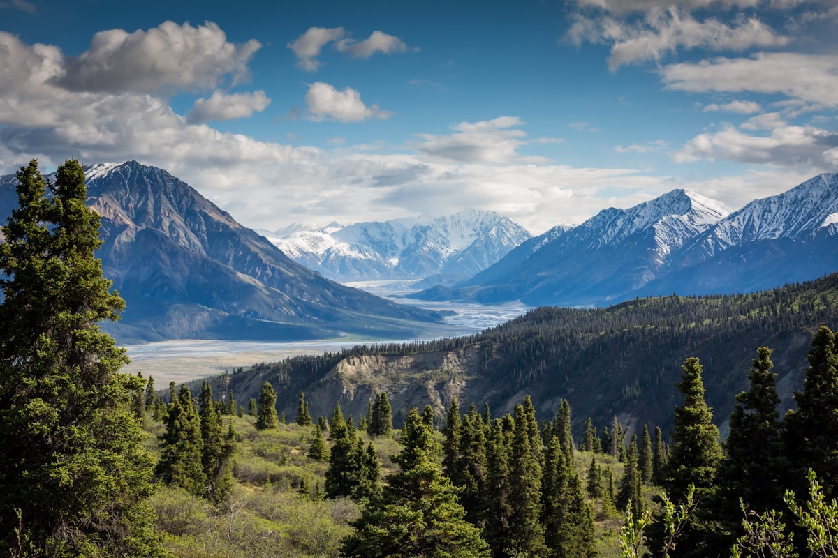
The Anjihai River (安集海河) has carved a deep, twisting canyon into the northern Tianshan foothills, exposing layered red, brown and yellow sediment in hypnotic bands. From above, the gorge looks like a wound in the green plain — hence “Red Scar.” Drone photographers love it: the serpentine river, the terraced walls, the contrast of rust-red rock against the Junggar Basin’s muted tones. On a clear day the striations run for kilometers.
What you won’t find is any development. This is farmland and grazing land above a dangerous edge. The beauty here is precisely its emptiness.
The geology of the Red Scar
The colors are the story. Like its developed cousin at Dushanzi, Anjihai is cut into the alluvial fans of the northern Tianshan — but here the river has sliced deeper and the exposed section is older and more contorted. The red and brown bands are iron-rich mudstones and conglomerates laid down as the range shed sediment over millions of years; the yellows are sulfur-tinted layers where mineral content changes. Because no one manages the site, the walls are eroding naturally — fresh slumps after each rainstorm reshape the rim, which is exactly why the edge is so unreliable underfoot. What you photograph one year may have crumbled into the river the next.
How to actually get there
This is the part that trips people up. Anjihai is near Shawan County (沙湾县), roughly 100 km west of Urumqi along the G30 (Lianhuo Expressway), and not far south of the Duku Highway’s northern section. There is no formal “entrance.”
- From Urumqi, take the G30 west toward Shawan (about 1.5–2 hours).
- Exit toward the Shawan / Anjihai area and follow local roads south toward the canyon rim.
- The rim is reached via agricultural tracks and a rough final stretch — a regular sedan can manage when dry, but a higher-clearance vehicle is more comfortable, and never attempt the side tracks after rain, when they turn to slick clay.
There is no signage at the critical points, and mobile coverage is patchy. Download offline maps before you leave the expressway, and don’t trust a single GPS pin — they often land you on the wrong side of the gorge, staring at the view you can’t reach. The nearest fuel and food are back on the G30, so arrive with a full tank.
The safety reality — please read
I am not exaggerating when I say this place can kill. The canyon edges are unfenced, often crumbly, and the drop is sudden and steep — easily 80–150 meters to the river. Wind gusts can be strong enough to push a person. People have died here taking selfies too close to the lip.
Rules I follow and recommend:
1. Stay well back from the edge. Two meters is not enough on eroding soil; give it five.
2. No drones near the lip if wind is up — and the wind is frequently up.
3. Go with a downloaded offline map and a full fuel tank. The nearest real services are back on the G30.
4. Tell someone your plan and expected return time.
5. No facilities — bring all water, food and a means to use the bathroom behind your car. Pack out everything.
6. Turn back if tracks are wet. A stuck car out here is a serious problem, not an inconvenience.
This is exactly the kind of remote-driving discipline the Duku Highway self-drive guide preaches, and it applies tenfold at an unmanaged site.
When the wind rules
The nickname “Screaming Canyon” is literal. Wind funnels down the gorge year-round and can hit strong, gusting speeds that make standing near the lip genuinely dangerous — not just for drones but for people. On my second visit a gust nearly took my hat and camera into the void. If the wind is whipping the grass flat and you feel it pushing, that is your signal to retreat from the edge entirely. Calm, still mornings after a dry spell are the safest and also the best for photographs, when the banded walls sit in clean side light.
A safer way to see it
If the rim tracks worry you, there is a compromise. From the G30 itself, certain pull-offs near the Shawan stretch give a distant view of the red gorge without any off-road driving or cliff-edge exposure. You lose the drama of standing at the lip, but you keep your life and your axle. For families with children, or anyone unsure about the side roads, this is the responsible choice — and the Dushanzi Grand Canyon guide an hour east gives you the railed, photographed version with none of the risk.
The view from the rim
Stand at the edge (safely back) and the payoff is immediate: a serpentine river far below, terraced red walls stepping down in bands of rust, ochre and pale yellow, and the green agricultural plain stretching to the Junggar Basin beyond. On a clear day the scale is cinematic — the gorge winds for kilometers in both directions and the only sound is wind and the occasional tractor from the fields behind you. This is the shot drone pilots chase, but even on foot the panorama is worth the rough drive. The colors are most saturated after a dry spell, when dust hasn’t dulled the rock, and worst in flat midday glare.
Best time and conditions
- Late spring to early autumn (May–September): the only sensible window. Dry tracks, long daylight.
- Avoid after rain or during snowmelt when the side roads are impassable.
- Light: mid-morning and late afternoon both work; the red strata photograph best with side light. Avoid the flat glare of midday.
There is no “season” ticket or closure because there is no management — but that also means winter access is genuinely dangerous (ice, isolation). I’d skip it November–March.
What to bring
Self-sufficiency is not optional here:
– At least 2 liters of water per person; there is nothing to buy.
– Food, a hat, sunscreen, and a windproof layer — the gorge is exposed and gusty.
– A full fuel tank and a spare; the side tracks are hard on tires.
– Offline maps downloaded before you leave the expressway.
– A trash bag — pack out everything you bring in.
Pairing it with Dushanzi
The natural comparison is the developed Dushanzi Grand Canyon guide, about an hour’s drive east. Many travelers do both in a day: Dushanzi for the safe, glass-walkway experience, then Anjihai for the wild version. If you’re continuing south on the Duku or detouring to the Tianshan Panlong Road guide, Anjihai fits neatly into a Shawan-region stop before the climb.
Just remember the contrast: one is a theme-park rim, the other is the raw earth expecting nothing and offering no help.
FAQ
Is Anjihai Grand Canyon officially open to visitors? There’s no formal scenic area, ticket or management. People visit independently, but you do so entirely at your own risk on open land.
Can I drive right to the edge? You can reach the rim via rough agricultural tracks, but the final stretch is unpaved and weather-dependent. Don’t drive it when wet.
Is it safe for families with kids? Only with extreme vigilance — there are no fences and a deadly drop. I would not bring small children close to the lip.
How is it different from Dushanzi Grand Canyon? Dushanzi is a developed, railed, ticketed site; Anjihai is completely undeveloped, free, and far more dangerous but more “authentic.”
When is the best time to go? Late spring through early autumn on a dry day; avoid rain, snowmelt and winter.
Do I need a permit or border pass? No permit is required for the canyon itself, but carry ID and follow checkpoint rules on the surrounding roads.
Final word
Anjihai is Xinjiang at its most honest — no railings, no hand-holding, just red earth and a long drop. Go if you’re experienced and careful; otherwise enjoy the view from a safe distance and save the thrill for Dushanzi.
Written by Karl Huang, a Xinjiang-based travel writer. Anjihai has no official management or fixed access — track conditions, access points and local rules can change, so confirm the current situation with local Shawan authorities before you travel.