

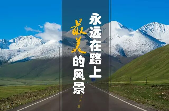
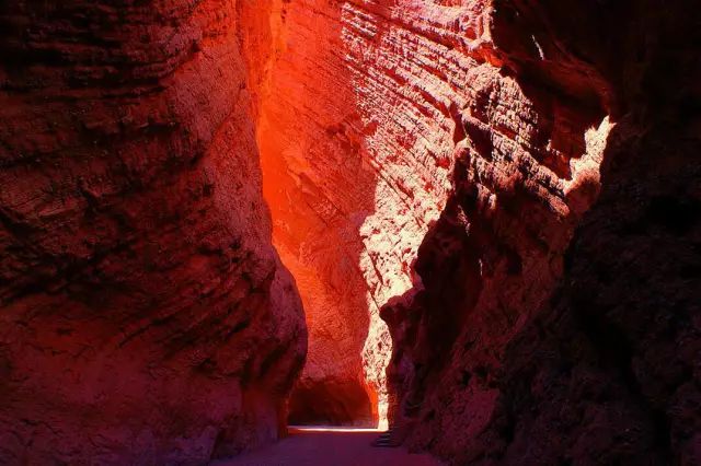
If Xinjiang has one road that defines the self-drive dream, it is the Duku Highway. In a single day of duku highway self drive you climb from flaming red canyons at 1,000 m to snow-fed passes above 3,400 m, passing glaciers, spruce forests, and alpine meadows. Chinese travelers call it “a road that compresses one-third of the country’s landscapes into one day.” This guide covers the route, the all-important duku highway opening dates 2026, and practical tips for foreign drivers.
The route at a glance
- Length: 561 km
- Connects: Dushanzi (north) to Kuqa (south), crossing the Tianshan
- Built: opened to traffic in 1983 after a decade of construction by army engineers
- Drive time: 10–12 hours non-stop; plan a full day with stops
- Surface: fully paved, two lanes, many switchbacks
The highway is the spine of any xinjiang road trip itinerary that includes the northern and southern arcs. It slices 1,000 km off the old roundabout route between northern and southern Xinjiang.
When it opens (and closes)
The Duku Highway is seasonal. Snow closes the high passes for roughly half the year. Recent patterns:
- Opens: early June (sometimes late May in warm years)
- Closes: late September to mid-October, depending on first snowfall
Always check the duku highway opening 2026 announcement before you commit. The best time of year for a Xinjiang road trip overlaps almost exactly with the Duku’s open window.
Scenery zones, north to south
- Dushanzi → Qiao’erma (north): red canyon walls give way to spruce forest and the first switchbacks.
- Hashiligen Pass (3,400 m): the high point, often with roadside snow even in July.
- Qiao’erma: a supply stop and memorial to the road’s builders; last reliable fuel for a while.
- Grassland descent: open meadows near Bayinbuluke (a great overnight if you are on the northern Xinjiang road trip loop).
- Kuqa red canyon (south): the dramatic, Mars-like finale before the town of Kuqa.
Driving tips for foreign travelers
- Permits: the Duku itself does not require a border defense permit, but you will pass ID checkpoints. Carry your passport and, if self-driving, your temporary driving permit.
- Weather: conditions change fast at altitude. A sunny morning can become a sleet storm at the pass. Check the forecast and start early.
- Fuel: fill up in Dushanzi or Kuqa before entering; Qiao’erma has limited supply.
- Speed: enforced limits drop on curves; watch for stopped tour buses and photo-stopped cars.
- No drones in some sections near military areas — respect signage.
Safety & etiquette
The Duku is busy in July–August with domestic tour buses. Our Xinjiang road trip safety guide covers checkpoints and altitude. Pull fully off the road to photograph; never stop in a tunnel or on a blind curve.
Duku vs the alternatives
The Yizhao Highway is shorter and steeper (closed even longer); the Taklamakan desert highways are flat and lonely by comparison. For most visitors the Duku is the must-drive, with the others as supplements.
FAQ
Can RVs or large vehicles use it? Restrictions apply to vehicles over a certain length in peak season; check current rules.
Is there cell signal? Spotty in the middle section. Download offline maps.
Where should I sleep? Bayinbuluke (midway) or push to Kuqa / start from Dushanzi.
Final word
The Duku Highway is the reason many travelers fall for Xinjiang. Build it into your loop, watch the opening dates, and give it a full, unhurried day.
Written by Karl Huang, a Xinjiang-based travel writer. Road-opening dates change yearly — confirm with local traffic authorities before you go.