

For years, reaching the storybook village of Hemu meant a long, slow crawl over a rough mountain pass, or a detour through Burqin and a bus transfer. The Ahei Highway changed that. This is the road that finally lets you point a car from the flat industrial plains of Karamay almost straight into the heart of the Altai, arriving at Hemu’s wooden houses and birch forests in a single, smooth drive. It is one of the most useful new roads in northern Xinjiang — and one of the most beautiful approaches to the Kanas region you can take.
This guide covers the route, the season, the practical stops, and how the Ahei compares to the older way in.
What the Ahei Highway is
The Ahei Highway is the S232, connecting Karamay in the north to Hemu (and onward to the Kanas scenic area) in the Altai mountains. “Ahei” is short for Altai–Hemu. Where the old route forced you through Burqin and then a separate, often congested access road, the Ahei cuts a more direct line through the northern foothills, dramatically shortening the drive and smoothing the surface.
The road is paved and in good condition for its open season. It is not a high-switchback drama like the Duku or the Yizhao; it is a fast, scenic connector — which is exactly its value. You spend less time white-knuckling the wheel and more time looking at the view.
The season
The Altai is harsh in winter, and the Ahei follows the rhythm of the mountains.
- Open season: roughly late May through early October, weather permitting.
- Peak beauty: September to early October, when the birch and larch turn gold and Hemu becomes the most photographed village in Xinjiang. This is also the busiest time — book accommodation well ahead.
- Summer: green, cool, and far less crowded than peak autumn; excellent for families.
- Winter: closed to through traffic by snow. The Kanas region largely shuts its access roads.
Because the Altai sits at high latitude, even summer nights are cool. If you’re linking this into a broader northern Xinjiang road trip loop, build in buffer days — an early snow can shorten the season without notice.
The drive, Karamay to Hemu
1. Karamay → northern foothills. You leave the city of oil wells and the surreal “Devil’s City” yardang landforms behind. The first stretch is open steppe and low hills. Fuel and supplies are easy here; top off before the climb.
2. The forest belt. The road enters birch and spruce forest as elevation climbs. This is the section people remember — sunlight filtering through pale trunks, the air turning sharp and clean. Pull-offs exist but are limited; use them when you find them.
3. The high meadow and snowline. At the top of the pass the Altai reveals itself: rolling tundra, distant glaciated peaks, and if you’re lucky a glimpse of snow even in August. Cell signal thins here.
4. Descent to Hemu. The road drops toward the Hemu River valley and the wooden village appears — a cluster of timber houses with attended smoke, horses in the fields, and a silence that feels older than the road you arrived on.

Practical tips
- Fuel: fill in Karamay. Reliable fuel is scarce in the mountains. The Kanas scenic area has limited, often queued, stations in peak season.
- Accommodation: Hemu and the Kanas area book out in October. Reserve weeks ahead. Inside the scenic area, private cars are restricted in peak season — you may need to park at a transfer lot and take the shuttle, so check current rules before you drive all the way in.
- Checkpoints: routine ID/passport checks at the scenic-area boundary. Foreign travelers carry their temporary driving permit and passport.
- Weather: pack layers. The pass can be 15°C colder than Karamay. A windproof jacket is worth its weight.
- Timing: aim to arrive at Hemu before sunset if you want the famous sunrise platform shot the next morning — the viewpoint above the village fills before dawn in autumn.
Ahei vs the old Burqin route
The old way in ran Karamay → Burqin → Kanas/Hemu, a longer, slower road with more village traffic and a notorious bottleneck at the scenic-area gate. The Ahei removes most of that friction. The trade-off: the old route lets you see Burqin (a pleasant riverside town with a famous night market) and the colorful Kanas Lake approach from the north. Many travelers do the Ahei in and the Burqin road out, or vice versa, to see both.
If your priority is simply “get to Hemu efficiently and beautifully,” the Ahei wins. If you want the maximal scenic sampler, loop it.
Pairing it with Kanas
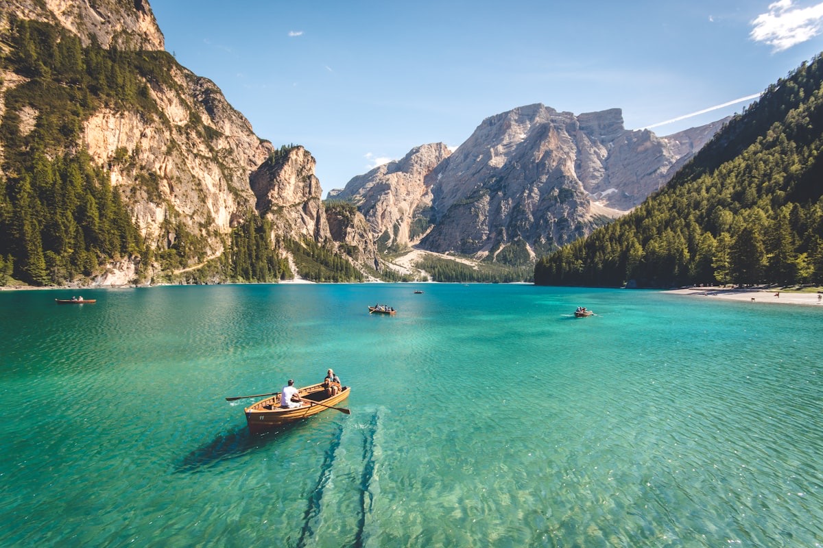
Hemu is the quieter sibling of Kanas. Where Kanas Lake draws the big crowds for its turquoise water and the legendary “lake monster” folklore, Hemu is about the village, the birch, and the slow morning light. A sensible plan: arrive Hemu the afternoon before, shoot sunrise, then continue to Kanas Lake for the day, and exit via Burqin. That sequence avoids backtracking and uses the Ahei for its strength — the arrival.
FAQ
Is the Ahei Highway open year-round? No. It follows the Altai season, roughly late May to early October. Winter closes it.
Can a normal car do it? Yes. Paved and maintained in season; no 4WD required.
Do I need a border permit? Not for the highway itself. The Kanas scenic area has its own entry system and checkpoints; carry ID/passport.
How long is the drive? Karamay to Hemu is roughly 4–5 hours with stops, depending on scenic-area transfer rules.
Is it worth it in summer? Absolutely — cooler, greener, and far less crowded than the October gold rush.
Final word
The Ahei Highway is the road that finally made Hemu easy. It is not the most famous road in Xinjiang, but for anyone heading into the Altai it is the smartest one — fast where it should be, beautiful where it counts, and a perfect arrival into the wooden village that defines the region. Time it for autumn if you can; take it in summer if you value calm.
Written by Karl Huang, a Xinjiang-based travel writer. Scenic-area entry rules and seasonal closures change year to year — confirm with local authorities before you travel.