

Ten days is the sweet spot for a first Xinjiang road trip. It is long enough to cross the Tianshan on the Duku Highway, sleep beside Kanas Lake, watch the sun hit Sayram at dawn, and still have a day for the Silk Road heat of Turpan. I have driven this loop more times than I can count, and the version below is the one I give friends who land in Urumqi with ten free days and a rental car.
The spine of the whole trip is the Duku Highway. Everything else hangs off it. Plan your dates around when it opens — usually early June — because if you arrive in May the northern half of this itinerary simply does not exist yet. Read the best time for a Xinjiang road trip before you lock in flights.
The route at a glance
Urumqi → Dushanzi → Duku Highway → Nalati → Bayinbuluke → Burqin → Kanas → Hemu → Urumqi → Sayram Lake → Turpan → Urumqi.
Total driving is roughly 2,600–2,900 km depending on detours. That is a relaxed average of 260–290 km per day, with two genuinely long transfer days you should expect. Distances below are real road distances, not straight lines.
Day-by-day plan
Day 1 — Arrive Urumqi, collect the car. Pick up your SUV at Diwopu airport. Spend the afternoon on the ring road or rest. If you have energy, Heavenly Lake (Tianchi) is 70 km northeast, but I would save it. Sleep in Urumqi.
Day 2 — Urumqi to Dushanzi (~250 km, 3 hours). Take the G30 expressway west. Dushanzi is the northern gateway to the Duku and home to the dramatic Dushanzi Grand Canyon, a red-earth gorge carved by the Kuitun River. Sleep here and fuel to full — the next day’s mountain has no reliable station.
Day 3 — Dushanzi to Nalati via the Duku (~230 km, 5–6 hours). This is the day you remember. The Duku climbs to the Hashilagen Pass at about 3,400 m, drops through spruce forests and alpine meadow, and spits you out near Nalati. My full Duku Highway self-drive guide covers the stop cadence. Overnight Nalati.
Day 4 — Nalati to Bayinbuluke (~80 km, 1.5 hours). Short, slow. Bayinbuluke has the famous nine bends of the Kaidu River and the Swan Lake reserve. Sunset here is the photo of the trip. Stay in the town just outside the scenic area.
Day 5 — Bayinbuluke to Burqin (~600–650 km, full day). Retrace the Duku north to Dushanzi, then G217 through Karamay to Burqin. This is the toughest transfer. Break it at Karamay. Burqin is the base town for Kanas and has a lovely riverside night market.
Day 6 — Burqin to Kanas (~140 km, 2.5 hours). Enter the geopark, drive to the lakeside. The water is an impossible turquoise. My Kanas Lake guide explains the shuttle-bus system and where the Three Bays sit. Sleep inside at Jiadengyu or push to a lakeside guesthouse.
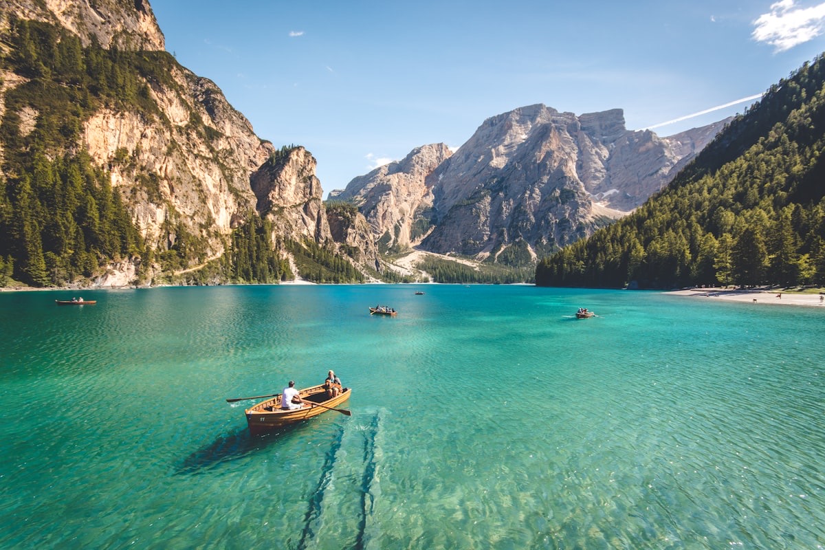
Day 7 — Kanas to Hemu (~70 km). Hemu is the prettiest of the three villages, all birch and timber roofs. Roads inside the park are shuttle-only in peak season, so confirm the self-drive rule when you buy tickets. Overnight Hemu.
Day 8 — Hemu to Urumqi (~650–700 km). Long haul back south via Fuhai and the G216/ G30. Start early. This is the day to accept you are trading scenery for progress. Sleep in Urumqi.
Day 9 — Urumqi to Sayram Lake (~550 km, 6 hours). West on the G30 to the “last tear of the Atlantic.” The Sayram Lake guide covers the ring road. Camp or stay at the lakeside cabins. Dawn is the moment.
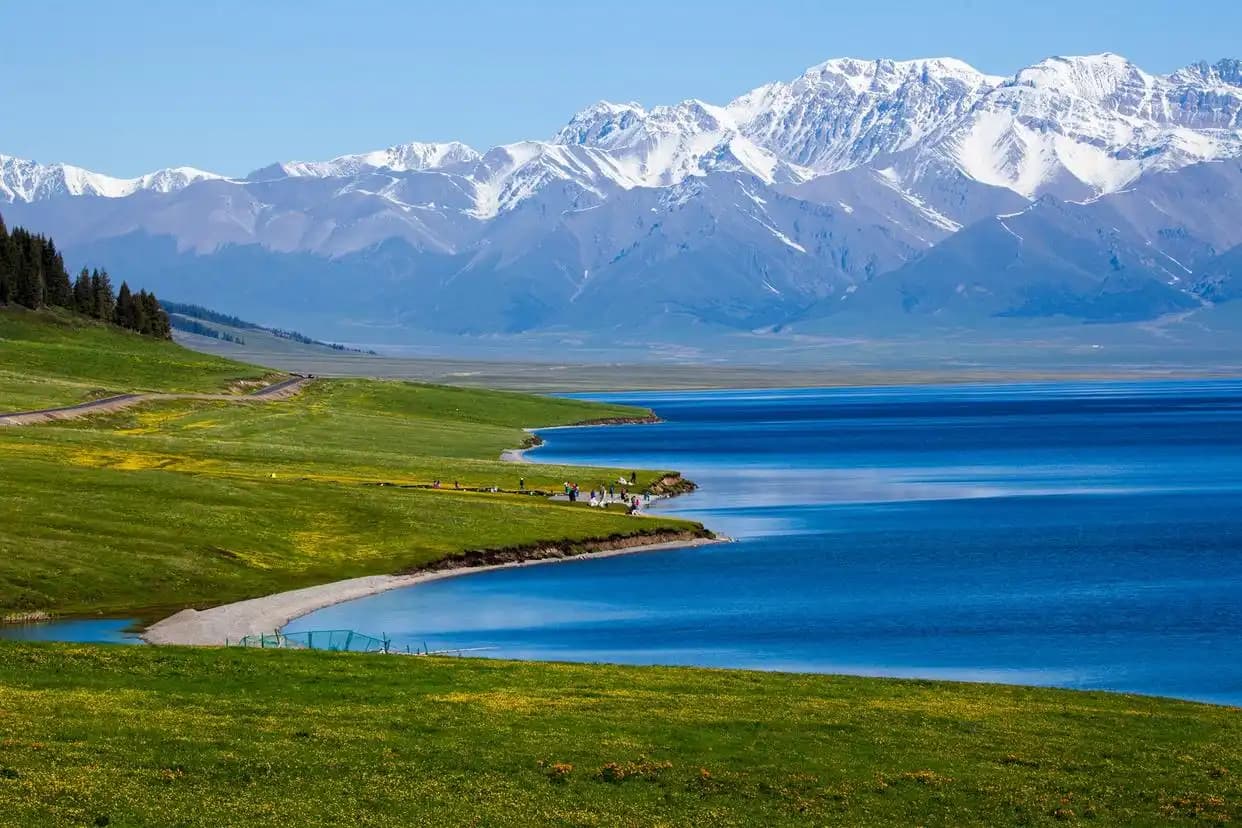
Day 10 — Sayram to Turpan to Urumqi (~600 km). Drop south past Urumqi to Turpan: the Grape Valley, the Flaming Mountains, the Jiaohe ruins. Then return to Urumqi and fly out. If your flight is early, cut Turpan and just breathe at Sayram.
Altitude and what your body actually feels
The loop swings from 154 m below sea level at Turpan to 3,400 m on the Duku’s Hashilagen Pass. Most nights sit high but comfortable: Urumqi ~800 m, Dushanzi ~500 m, Nalati ~2,000 m, Bayinbuluke ~2,500 m, Kanas ~1,300 m, Sayram ~2,070 m. None of these demand altitude medication for most people, but the Duku summit is cold and thin — I have watched fit travelers get winded at the pass lookout. Ascend gradually, hydrate, and do not plan a hard hike the same day you cross the top. If you are sensitive, spend the night at Nalati (2,000 m) before the climb rather than pushing straight through.
The seasonal window for this exact loop
This itinerary only works from roughly early June to late September. The Duku typically opens in the first week of June and closes after the first snow, often in early to mid-October. Sayram is frozen and ferociously windy from November through April, so the Day 9 lakeside dawn is a summer-and-early-autumn privilege. July and August are green and crowded; Kanas and Sayram lakeside rooms book out weeks ahead. I prefer the last two weeks of September: the Duku is still open, the larches at Kanas turn gold, and the tour buses thin out. Turpan, at the other extreme, bakes above 40°C in July — fine for a half-day visit, miserable for lingering.
Checkpoints on this loop
You will pass several police checkpoints, clustered in two zones: the G30 corridor around Urumqi and the approach to Kanas near the Altai border. They are routine and quick. Keep your passport (or ID) and rental agreement in the glovebox sleeve, and have them in hand before you reach the window. Dashcams should be switched off if asked, and you should never photograph a checkpoint or a military site — that is the one action that turns a friendly wave-through into a problem. Foreign travelers are waved through constantly; the checks exist for border-zone control, not to hassle visitors.
Fuel and supply cadence
On the G30 and G217 the stations are frequent — every 40–80 km — but the moment you turn onto the Duku or into the Kanas geopark, the spacing widens and some pumps close early. I fuel to full at Dushanzi before Day 3 and again at Karamay on Day 5, and I never let the gauge fall below half on a mountain leg. Cash helps at small stalls: carry ¥200–300 in small bills for roadside fruit, water, and the occasional card-less pump. Supermarket resupply is easy in Urumqi, Karamay, Burqin, and Yining, so treat those as your provisioning anchors.
What to skip if you are short on time
If a day slips, drop Hemu (Kanas alone covers the Altai) or compress Turpan into a half day. Never skip the Duku — it is the reason this loop works. If you only have nine days, sleep in Burqin twice and shave the second Urumqi stop.
Practical numbers
- Rental SUV: roughly ¥400–700/day in 2026 peak season; book two weeks ahead in July–August.
- Fuel: budget ¥0.7–0.9 per km for a petrol SUV; the half-tank rule matters on the Duku and the Turpan approach.
- Park tickets: Kanas geopark ~¥230 with shuttle; Sayram ~¥145 with the ring-road bus; Bayinbuluke ~¥140.
- Seasons: Duku opens ~June, closes after first snow (often late September–October). Sayram is frozen and windy from November to April.
Driving reality check
Xinjiang is safe and the highways are excellent, but it is vast. Police checkpoints are routine — always carry your passport or ID and have your rental papers handy. The long transfer days (5 and 8) are tiring; swap drivers if you can. Download offline maps before you leave Urumqi, because signal dies in the Tianshan and the desert.
FAQ
Can I do this loop in a sedan? On the paved highways, yes — but an SUV is far more comfortable for the Duku’s switchbacks and any unpaved park access roads. I would not attempt the Pamir in a sedan.
When is the Duku actually open? Typically early June to late September or early October, weather permitting. The exact date shifts every year, so confirm locally before you book Day 3.
Do I need a border permit (边防证) for this route? Not for the 10-day loop above — it stays north of the Pamir. You only need the permit if you push to Tashkurgan or Khunjerab.
Is 10 days enough for both Kanas and Turpan? Barely, and only with two long drive days. If you hate long hauls, choose north (Kanas/Sayram) or south (Turpan/Kashgar), not both.
How much should I budget per person? A comfort trip runs roughly ¥800–1,200/day all-in (car, fuel, hotels, food, tickets) for two people sharing. Solo drivers pay more per head for the rental.
Can foreigners self-drive here? Rules vary and have tightened; some travelers use a local driver. Confirm the current license and permit situation with your rental company before arrival.
Final word
Ten days will not show you all of Xinjiang — nothing short of a month will — but this loop gives you the mountains, the lake, and the desert in one clean arc. Drive the Duku once and you will start planning the next trip before you land.
Written by Karl Huang, a Xinjiang-based travel writer. Seasonal road openings and permit rules change year to year — always confirm the Duku and checkpoint situation with local authorities before you travel.