

If ten days is the appetizer, fifteen is the meal. With two weeks you can finally do what most visitors only dream of: loop the north for its lakes and grasslands, then cross the entire Tarim Basin to Kashgar and turn up into the Pamir. I drove this exact grand loop last summer, and the rhythm — north green, south gold, Pamir white — is the best geography lesson Xinjiang offers.
This is a long trip: roughly 4,000–4,500 km of driving. But the pace is gentle because the overnights are well placed. Use my northern Xinjiang road trip loop and southern Xinjiang Tarim loop as deeper dives on each half.
 }
}
The full route
Urumqi → Dushanzi → Duku → Nalati → Bayinbuluke → Kanas/Hemu → Urumqi → Sayram/Yining → Urumqi → Turpan → Korla → Kuqa → Aksu → Kashgar → Tashkurgan (Pamir) → Kashgar → fly or drive back.
Days 1–7: The north
Day 1 — Urumqi. Collect the car, stock supplies, rest.
Day 2 — Urumqi to Dushanzi (~250 km). G30 west. Overnight Dushanzi.
Day 3 — Dushanzi to Nalati via Duku (~230 km, 5–6 hrs). The Hashilagen Pass at ~3,400 m. Overnight Nalati.
Day 4 — Nalati to Bayinbuluke (~80 km). The nine bends at sunset. Overnight Bayinbuluke.
Day 5 — Bayinbuluke to Burqin (~600 km). Long transfer via Karamay. Overnight Burqin.
Day 6 — Burqin to Kanas (~140 km). Lakeside day. Overnight Jiadengyu or inside.
Day 7 — Kanas to Hemu (~70 km), then back toward Urumqi (~650 km) or break at Fuhai. I prefer breaking it: sleep in Burqin again and drive to Urumqi on Day 8.
Days 8–10: Ili and the return south
Day 8 — Urumqi to Sayram Lake (~550 km). Dawn at the lake.
Day 9 — Sayram to Yining (~90 km) and the Ili valley. Lavender (June–July), the green Nalati grassland if you missed it, Yining’s night bazaar. Overnight Yining.
Day 10 — Yining to Urumqi (~700 km) or fly. Driving is a full day; many travelers fly Yining→Urumqi to save it. If driving, overnight Urumqi.
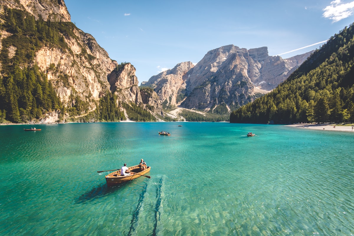 Nalati grassland in summer green” />
Days 11–13: The Tarim crossing
Day 11 — Urumqi to Turpan (~190 km). The Flaming Mountains, Grape Valley, Jiaohe ruins. Overnight Turpan.
Day 12 — Turpan to Korla via Korla (~380 km). Past the wind farms and the edge of the Taklamakan. Overnight Korla.
Day 13 — Korla to Kuqa (~280 km). The Kuqa Grand Canyon and the Kizil caves if time allows. Overnight Kuqa.
Day 14 — Kuqa to Aksu to Kashgar (~460–520 km total). A long desert day on the G3012. Overnight Kashgar old town.
Days 15–17: The Pamir turn
Day 15 — Kashgar to Tashkurgan via the Karakoram Highway (~300 km). This is the crown. The Karakoram Highway self-drive guide details the passes. Overnight Tashkurgan (~3,100 m).
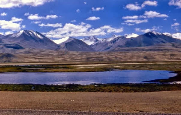
Day 16 — Tashkurgan to Karakul Lake and back, or to Kashgar (~200 km round). Muztagh Ata at 7,509 m towers over Karakul. Sleep in Kashgar.
Day 17 — Fly out of Kashgar (recommended) or begin the long drive back north.
Altitude on the grand loop
This route spans a 3,500 m vertical range. Urumqi sits at ~800 m; Turpan drops to 154 m below sea level; the Duku summit hits 3,400 m; and the Pamir pushes you to Tashkurgan at ~3,100 m with passes on the Karakoram reaching 4,000 m+. The smart move is to let the first week do the acclimatizing: you are high on the Duku and at Bayinbuluke before you ever reach the Pamir, so by Day 15 your body has met altitude gradually. Still, the jump from Kashgar (1,300 m) to Tashkurgan (3,100 m) in one drive is real — I drink extra water that day and skip the strenuous hike at Karakul. Watch for headache and nausea; if they come, descend toward Kashgar.
The seasonal window
The grand loop needs both the Duku and the Pamir open simultaneously, which narrows your window to roughly late June through mid-September. The Duku usually opens in early June but the high Pamir side roads and the Ili lavender are at their best from late June. By early October the Duku can close on the first snow and the Pamir passes firm up with ice. I would not attempt this full loop before the last week of June or after mid-September. If your dates fall outside that band, cut the Pamir and run a north-plus-Tarim version instead.
Checkpoints and the border permit
You will meet checkpoints in three bands: the Urumqi G30 corridor, the Aksu–Kashgar stretch, and the Kashgar–Tashkurgan Pamir road. All are routine; keep documents ready. The border permit (边防证) is mandatory only for Tashkurgan and is free, but you apply in Kashgar with your passport and should allow a few hours on Day 5 or 11 of the southbound leg. Do not leave it for the morning you drive — the office has its own hours and a queue in peak season. Foreign travelers should also confirm the current self-drive and permit rules with their rental company, as they have tightened at times.
Fuel, water and resupply cadence
On the Tarim (G3012) stations sit every 40–80 km, but the Pamir stretch from Kashgar to Tashkurgan has wider gaps and some pumps close early — fuel to full in Kashgar before Day 15. Water is easy in the cities but scarce on the Pamir; carry 3–4 L per person for the Tashkurgan overnighter. I treat Urumqi, Korla, Kuqa, Kashgar and Yining as provisioning anchors and never pass one without topping the tank and the cooler. Cash (¥200–300 small bills) covers roadside stalls and the occasional card-less pump.
Honest notes on the long desert drives
The Turpan–Kashgar stretch is flat, fast, and monotonous. Fuel stations sit roughly every 40–80 km on the G3012, but never let the tank drop below half in summer heat. The Pamir is different: thin air, high passes, and checkpoints. You need a border permit (边防证) for Tashkurgan — get it in Kashgar.
Costs for 15 days
- Car: ¥400–700/day SUV; for 15 days that is ¥6,000–10,000 before fuel.
- Fuel: ~¥2,800–3,500 for the full loop in a petrol SUV.
- Hotels: ¥250–600/night comfort tier; Kashgar and the Pamir are pricier in peak season.
- Food: ¥80–150/person/day eats well on laghman, naan, and kebab.
- Permits/tickets: border permit is free but costs time; major parks another ¥1,000–1,500 for two people.
Road quality by segment
The loop mixes four road characters. The G30 expressway (Urumqi–Dushanzi, Urumqi–Turpan, Yining–Urumqi) is fast, divided, and camera-controlled — easy miles. The Duku (G217) is fully paved but narrow with switchbacks and tunnel-less climbs to 3,400 m; an SUV is more comfortable but any capable car manages it in summer. The Tarim G3012 is flat, wide, and smooth — the long desert cruise where boredom, not difficulty, is the challenge. The Karakoram Highway (G314) to Tashkurgan is paved but rougher, with frost heave and the occasional washout; take it slow and watch for rockfall after rain. None require 4WD in the season window, but tire quality matters everywhere.
Connectivity and navigation
Signal is reliable on the G30 and in every city, but it dies in the Tianshan gorges, across the Taklamakan middle, and above 3,000 m on the Pamir. I download offline maps (Gaode/AMap or Maps.me) for the whole loop before leaving Urumqi, plus hotel confirmations as PDFs. A local SIM with data — China Mobile has the best Xinjiang coverage — is worth buying on day one. Don’t trust live navigation on the Pamir; the cached map and the frequent brown checkpoint signs are your friends.
Booking rhythm
In July–August book every bed ahead: Kashgar, Sayram lakeside, Bayinbuluke, and the Pamir guesthouses in Tashkurgan fill fast. In June and September you can often book a day ahead, and in the true shoulder (late May, early October) you can wing much of it. I lock the Duku-side nights (Nalati, Bayinbuluke) and the Pamir (Tashkurgan) first, then fill the cities around them.
FAQ
Is 15 days too much driving? No — it is about 280–300 km/day average, which is relaxed for Xinjiang. The Pamir and Duku days are the scenic peaks; the Tarim is the long, easy cruise.
Do I need the border permit for the whole loop? Only for the Tashkurgan/Pamir section (Days 15–16). Apply in Kashgar with your passport; allow a few hours.
Can I fly the return instead of driving back north? Absolutely. Most people fly Kashgar→Urumqi on Day 17 and drop the car there, saving two brutal days.
When is best for this loop? Late June to mid-September. The Duku and the Pamir are both open then, and the Ili lavender and grasslands are at their best.
Should I book hotels ahead? In July–August, yes — Kashgar, Sayram, and Bayinbuluke fill up. Shoulder months you can wing it.
Is the Karakoram Highway safe at altitude? It is safe but high; Tashkurgan is ~3,100 m and passes reach 4,000 m+. Ascend slowly, hydrate, and don’t push if you feel sick. See the altitude guide before you go.
Final word
Fifteen days lets Xinjiang unfold instead of flashing past. You will leave hoarse from the wind at Karakul and quietly addicted to the rhythm of empty highway. It is the loop I recommend to anyone who asks me, “What if I really want to see it all?”
Written by Karl Huang, a Xinjiang-based travel writer. Road openings, border-permit rules, and the Pamir checkpoint situation change — confirm the current requirements with local authorities before you travel.